Micasense Professional Multispectral Sensors Guide
Accurate information for your fields starts with quality sensors. Micasense offers professional multispectral cameras, namely: RedEdge-M, RedEdge-MX, and Altum; optimized for use in drones, with narrow band filters, calibrated outputs, and a size and weight that allows integration with all types of unmanned aircraft.
Micasense Professional Multispectral Sensors Guide: The Sensor that doesn't compromise!
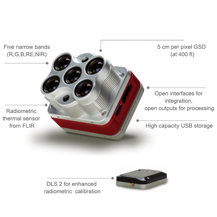
Integrates with almost any drones and contains many no moving parts generating data you can count on even in the toughest environments. It collects data in multiple outputs in one flight and it takes calibrated repeatable measurements to generate not only basic crop health diseases but also advance analytics. The Micasense Professional Multispectral Sensors are compact and powerful, yet extremely flexible. It captures five spectral bands at once, that means it gives you the RED, GREEN, BLUE, RedEdge and near-rare infrared bands. But the dedicated life sensor for better reflectance calibration, provides unparalleled accuracy. The RedEdge product line has been tested and proven worldwide. See why agricultural professionals around the world recognize it as the industry standard.
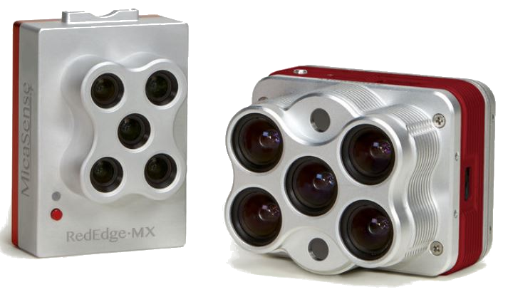
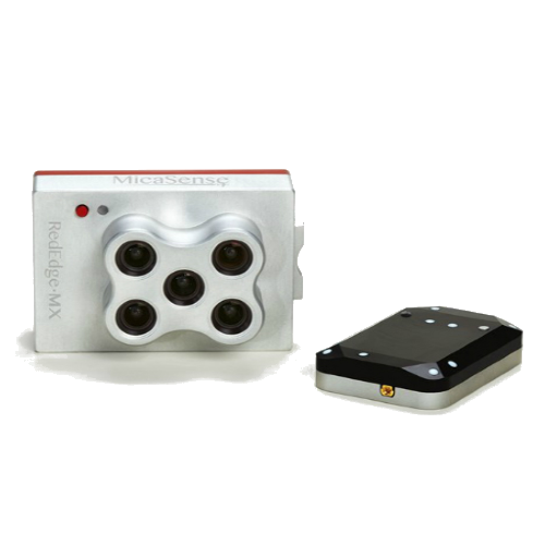
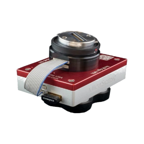
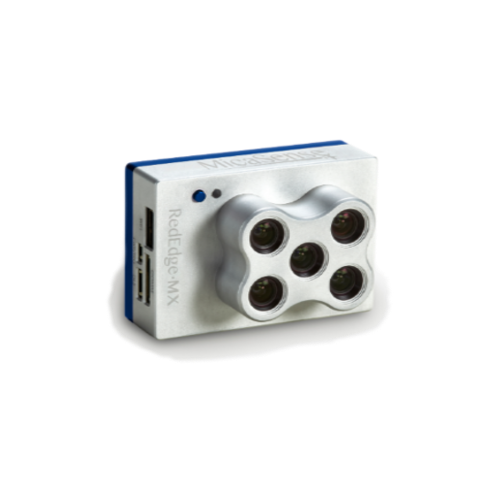
Micasense RedEdge-MX Professional Multispectral Sensor Kit
The technology you've come to depend on, now more durable and more accurate
- High image resolution; 8 cm/pixel at 400 ft (120 m).
- Operates in temperatures up to 60℃ or 140℉.
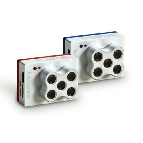
The Micasense RedEdge-MX is a rugged, built to last, professional multispectral sensor for agricultural drone mapping. The sensor that doesn’t compromise.
It captures both the spectral bands required for basic crop health indexes and additional bands to power further analytics. It gives you optimized GSD (resolution), a down-welling light sensor, a global shutter, RGB color images aligned with all bands, GigE Ethernet connectivity, removable Wi-Fi attachments, and platform-agnostic data and integration. All in a compact size that allows it to be used with a wide variety of unmanned aircraft systems.
- New metal case for extreme durability.
- New DLS 2 for enhanced light calibration.
- Five narrow-band multispectral bands.
- Capture plant health images and RGB (color) images in one flight.
- Designed for easy and flexible integration
- Single SD card stores all images with geotags.
RedEdge-MX Professional Multispectral Sensor DJI Skyport Kit
Same technology as RedEdge-M, now ready to integrate with DJI SkyPort enabled drones.
- Five narrow-band multispectral sensors.
- Capture plant health images and RGB (color) images in one flight. High image resolution; 8 cm/pixel at 400 ft (120 m).
- Single SD card stores all images with geotags.
- DLS 2 with embedded GPS for easier integration enhanced light calibration.
Want to know more with the Rededge-MX? Let's take a look on it!
With its compact size, RedEdge-MX works well with both multirotor and fixed-wing platforms. One flight is all it takes to generate RGB color, NDVI and advanced vegetation layers. Because it's calibrated, you can get an accurate picture of change over time in every output.
- Captures 10 narrow wavebands enabling advanced research applications
- Works with the drone and software you already have
- Synchronized capture of all 10 bands for pixel aligned imagery
- Own your data and choose whichever platform is best for you.
- Has five bands - blue, green, red, red edge, and near-infrared - were optimal for sensing crop health.
- With the sensors that was built, you can rely it on. Wherever you are in the field - predictable, tough and reliable - you can gather the data you need when you need it.
With the optimized GSD (resolution); the new DLS 2 light sensor; RedEdge-MX is one of the most flexible solutions on the market. An advanced sensor means that you can count on getting high quality, accurate data when you need it.
- Features RedEdge-MX Blue, a new version of RedEdge-MX that includes an additional group of filters
- Synchronized capture of all 10 bands
- Works with the drone and software you already have
Micasense Altum-PT - Thermal Multispectral and Highest Resolution Imagery
Redefining agricultural drone sensing
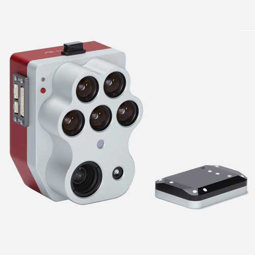
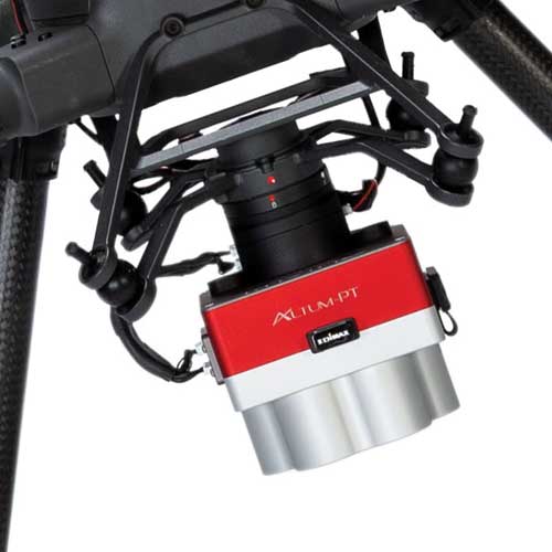
The Micasense Altum-PT is the latest sensor from Micasense and a first of its kind with fully calibrated multispectral and thermal imager. A revolutionary all-in-one solution for unparalleled sensing in a compact package. Ready to integrate with DJI SkyPort compatible drones.
- Integrates a radiometric thermal camera with five discrete spectral bands.
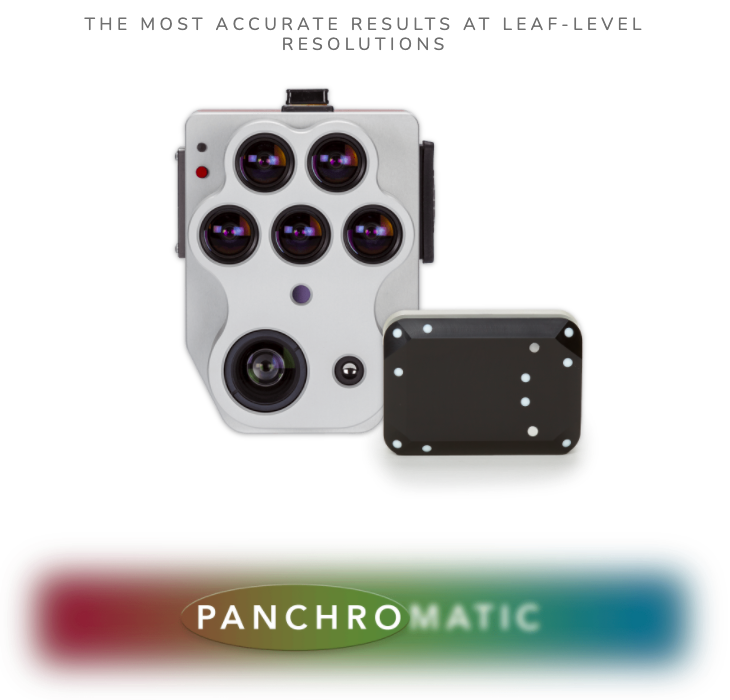
- An ultra-high resolution 12 MP panchromatic imager allows user to extract data at the plant-level.
- A whole new thermal imager that has twice the ground resolution of the last Altum sensor.
- Schedule the timing, frequency, and duration of water irrigation managing and also determine water usage for any project.
- Simultaneously capture all necessary bands in real time! More Power! More Data! More Control than ever before!
Micasense Altum-PT provides multiple options for integration - which includes the new, professional CFexpress removable storage, which captures 2 per second, w/ speedy turnaround time between flights (by changing cards), and super-intelligent fast card reader to increase upload speeds and decrease time between data management.
- Rugged design with no moving parts.
- Fly higher without sacrificing resolution ~ 1.2 cm (0.47in) pan-sharpened ground resolution at 60m (200ft)
- It captures faster rate for faster flight speeds.
- In a single flight, it captures data on plant health, phenotype and water stress/irrigation, fruit yield est., and more!
SYNCHRONIZED THERMAL AND MULTISPECTRAL IMAGERY
Simultaneously capture sensationally high resolutions of 3 spectral imagery; multispectral, thermal, and panchromatic data. These images are pixel-aligned outputs using the all new camera sensor from Micasense, the Altum_PT. Instead of tirelessly switching between the bands and going through the data, one-by-one, take control of your yield/crops/data and reduce your post-processing time.
THE STANDARD FOR HIGHEST RESOLUTION & DATA QUALITY
Same technology as RedEdge-PT, now ready to integrate with DJI SkyPort enabled drones.
- Five discrete-spectral band multispectral sensors.
- A brand new panchromatic thermal imager that sharpens the imagery to an incredibly accurate results (1.2cm at 60m)
- Capture plant health images and RGB (color) images in one flight. Super High image resolution; 1.2 cm (0.47in) pan-sharpened ground resolution at 60m (200ft)
- CF Express removable card stores all images captures 2 per second.
INTRODUCING THE
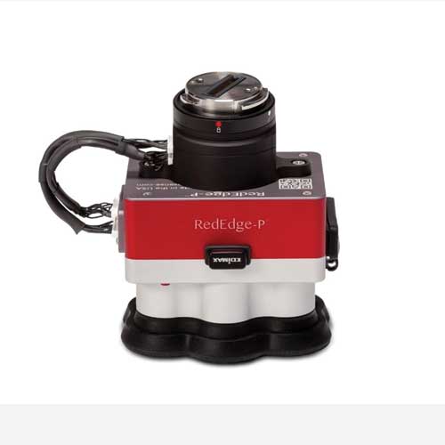
Micasense RedEdge-P Multispectral Kit
THE STANDARD FOR AN ALL-IN-ONE SENSOR w/ HIGHEST RESOLUTION/DATA
Are you ready for a high-resolution, pan-sharpened outputs of 2cm(60m) - meaning you will get twice the ground resolution imaging of the previous RedEdge sensors. This is all done because of the new panchromatic thermal imager that creates high resolution multispectral and RGB imagery that has a FOV and capture rate for more efficient flights. Trust MicaSense's ultra-cutting edge quality control to make a camera that is rugged enough, and smarter than the rest of the competition!
Same technology as the previous RedEdge, but more power and a 3-in-1 solution. Take a look at all of these key features:
- Capture six bands Capture six bands of multiple, high-end resolution outputs like NDVI & NDRE (Crop Vigor Indices), RGB data, & high resolution panchromatic imaging.
- This solution is compatible w/ large range of aircrafts or UAV's. Industry standard tools used for flight plans and data processing.
- Twice the spatial resolution when speeding at 60m, capture 2cm resolution using the panchromatic high-res imager. Higher quality multispectral imagery and RGB outputs.
- Rugged, hard-shelled design - IP4X rated for dust and splash protection.
Seamlessly Integrate with the M300, M200, or the M210!
Same technology as the previous RedEdge, but more power and a 3-in-1 solution. Take a look at all of these key features:
- Comes ready to integrate with DJI SkyPort compatible drones (M300 & M200/210 v2) & enables RTK capabilities when integrated with the M300.
- CF Express removable card stores all images captures 2 per second.
- Included: RedEdge-P sensor, Skyport adapter, lens cover, CFexpress, CRP2, DSL 2 w/ light sensor & integrated GPS, cables, mounting screws, hard carrying case, & DSL2 mast kit.
- Enables pan-sharpened RGB & multispectral outputs @ 2cm GSD from 60m.
What is multispectral imaging?
The colors we see in light are defined by the wavelength of that light. Plants absorb and reflect light differently depending on this wavelength. Plants typically absorb blue light and red light, while reflecting some green light. They also reflect a much larger amount of near-infrared (NIR) light, which is not visible to the human eye but is visible to multispectral cameras like RedEdge and Sequoia.
My camera will not power on, what should I do?
If from the drone, is the power cord connected properly? If from an alternative source, are you sure it is getting enough volts (5V for RedEdge, 6V for Altum)? If that does not help, please try an alternative power source to make sure it is the camera with an issue.
After checking the power source, please make sure you have the latest camera firmware. Do not attempt to upgrade the firmware if the camera is not getting the required voltage.
What are the recommendation for max flight speed?
The maximum flight speed will depend on the flight altitude and which sensor you are using. You can use a pre-flight calculator to enter the intended mission parameters for your flight. The calculator will output the time between captures, also ensure that is no less than 1 second for RedEdge. For Altum, we recommend keeping the time between captures at 1.5-2 seconds.
How can I preview thermal images in my computer?
Standard photo viewers such as Windows Photo Viewer or Preview will not be able to open thermal images from Altum. To do so, you will need a more dynamic image processing program, such as Fiji.
Can Micasense sensor be used over water?
Wind and sun reflection make capturing data over water with RedEdge-MX and Altum a complex process due to potential distortion and pixel saturation. However, the bands included in the Dual Camera Imaging System make it possible to identify and map vegetation in shallow water environments opening multispectral imagery to uses like riparian vegetation and coastal land mapping. However, when it comes to open water, stitching can be difficult due to pixel saturation. Some people use buoys as ground control points to help stitch together the imagery later.
My RedEdge will not recognize the SD card,what should I do?
First, please make sure you are using a recommended SD card and that your card is in FAT 32. Next follow the steps provided below:
- Download the latest firmware update for RedEdge-M/MX from the Atlas downloads page.
- Copy the .bin file to the root folder of the SD card.
- With camera powered OFF, insert SD card into camera.
- Provide a source of power to the camera and power camera ON if it doesn’t power on automatically.
- Wait approximately 30-60 seconds.
If your camera still does not recognize the SD card, please contact support.
Can I go back to previous firmware? Since the camera in no longer working after updating the firmware.
You mostly likely had an error when trying to update the firmware. Please try reinstalling the firmware making sure you follow these steps: **Reformat your SD card to FAT 32** Download the latest firmware from the Atlas downloads page. Copy the .bin file to the root folder of the SD card. With camera powered OFF, insert SD card into camera. Provide a source of power to the camera and power camera ON if it doesn’t power on automatically. Wait approximately 30-60 seconds.
I can’t connect to my sensor’s WiFi
Most WiFi issues mean your camera isn't getting enough power, or interference from other connections like your drone's remote control. Make sure you are giving the camera enough power, and try turning off your drone's remote control. Note that the WiFi isn't meant to be connected to while the drone is in flight. Powering the camera through your computer's USB port is not supported.
My Thermal degrees after processing seem wrong. How can I fix this?
When processing your Altum data in Pix4D and Agisoft, you may notice that your thermal (LWIR) band output has much higher than expected values. This is because the output units are centi-Kelvin. In order to convert the temperature values from centi-Kelvin to a unit that is easier to interpret, you will need to divide the output by 100 (which gives you Kelvin), and then subtract 273.15 to convert to Celsius.
I looked around other online stores, but chose UAVPrime. Glad I did. They had me flying by the end of the week!
I called in over the phone and was amazed at the service. They took real good care of me.
After being let down by another store, I found UAVPrime. Andrew was helpful and got me on the right track!
